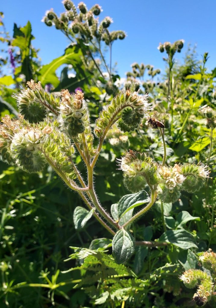
This June, Marion SWCD hosted a Conservation Club event for lifelong learners to join together for a day on the river to hear about riparian restoration management from the landowners themselves. While the river was still flowing high and the native flowers were blooming, we explored a range of riparian restoration practices at a large and a small site along the North Santiam River.
What is a Riparian Zone?
Riparian zones are the transitional areas between flowing water and land that encompass a range of plant and wildlife species and have great impacts on the entire watershed. Riparian habitats include rivers, streams, springs, seeps, terraces, lakes, and low-elevation alluvial floodplains. These habitats are found at all elevations from the shores of the coast and valley bottom floodplains to alpine torrents. They are shaped over long periods of seasonal flooding, scour, and soil deposition. The benefits provided by riparian zones to humans, animals, and the land are countless. Healthy riparian zones are crucial in cycling nutrients, improving water quality and quantity, preventing wildfires, providing spawning grounds for endangered salmonids and amphibians, supporting all levels of the ecosystem food chain, preventing soil erosion, and much more.
Many riparian areas in our District are degraded and no longer provide their beneficial functions due to reduced water quantity and sedimentation caused by poor management practices along streams and rivers. It is inspiring when we see landowners making the effort to restore these habitats on their own properties, and we applaud them for stewarding these highly important ecosystems.
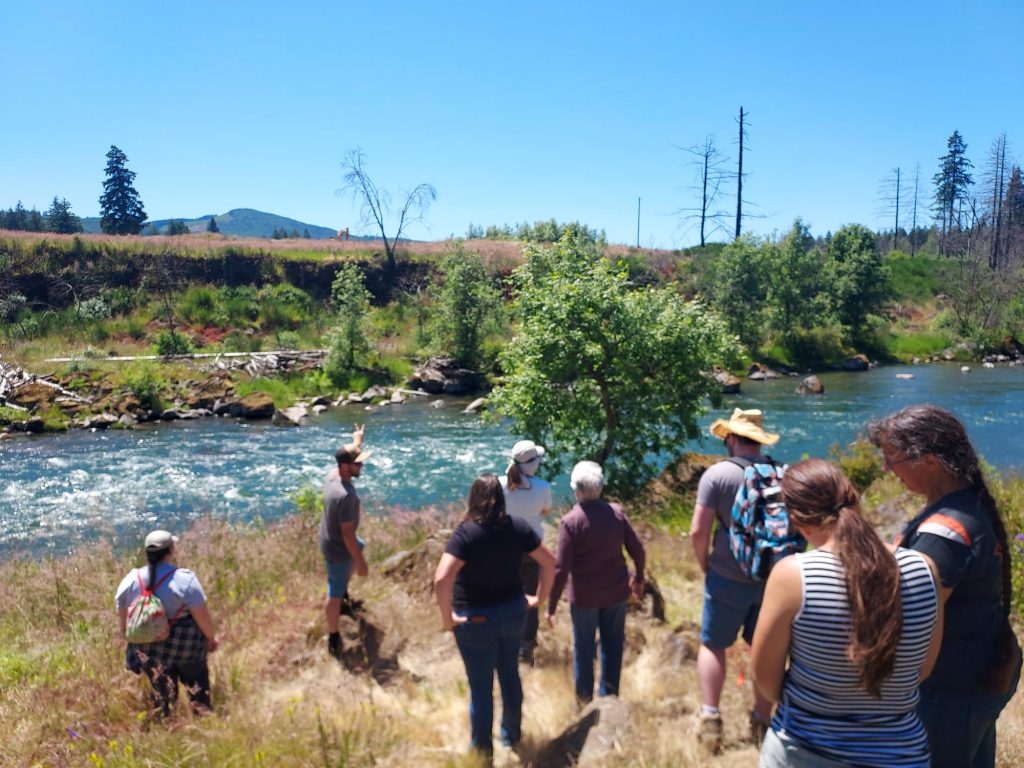
On this tour, we visited two landowners who are making a difference in their own riparian zones. On a beautiful Tuesday morning, the group all met at the Marion SWCD office to gather for coffee, introductions, and to car pool to the tour stops. The sun was shining, the birds were singing, and the smell of sunscreen and coffee invigorated us to start our day of learning. We drove just ten minutes from the office to our first site called Chahalpam, owned by our friends in conservation, the Confederated Tribes of Grand Ronde.
Chahalpam: Place of the People
The Confederated Tribes of Grand Ronde (CTGR) own and restore this riparian floodplain property in the North Santiam watershed, which has significant cultural and ecological value. Historically, this site was home to the Santiam band of the Kalapuya, and the riparian habitats of the river were rich and complex with a diversity of plant and animal species. “Cha” means place, and “Halpam” is the Santiam Kalapuya word for themselves in their language. Our lovely hosts Lindsay McClary, Jeremy Ojua, and Anna Ramthun, who all work for CTGR, shared their invaluable knowledge and experiences with restoration and taught us so much about the incredible efforts that have gone into this site.
Pre-European Site Condition
Pre-European settlement, this floodplain was a mosaic of evergreen and deciduous tree and shrub species with robust canopy layers: native willows, dogwood, and Douglas spirea covering the river bank, and a riparian gallery of black cottonwood, Oregon ash, red alder and western red cedar providing a shady refuge for wildlife. This is where Upper Willamette Spring Chinook salmon and winter steelhead, now listed under the Endangered Species Act, were plentiful, and nourished all components of the ecosystem from local wildlife to the forest soil biota. The ponds created by the river were home to the Oregon Chub, which was recently de-listed from the ESA thanks to the efforts of amazing landowners like the Tribes.
Impacts of Agricultural Production
This 462-acre property was previously owned by producers who raised and harvested various crops. Over time, agricultural practices compacted the soil, changed the plant community, and provided a seed bed for invasive weeds. To help get the land back to its native habitat, the Tribes re-acquired the property in phases starting in 2013. With the support of multiple partners including Bonneville Power Administration and Oregon Department of Fish and Wildlife this site has been protected by three conservation easements to ensure it’s long term restoration and recovery. At the time of Tribal acquirement in 2013, 195 acres of the property were still in agricultural production. Slowly, the Tribes have been phasing out sections of the property from ag production to be added to the restoration efforts, and now only 90 acres remain in ag production, which will eventually be restored as well.
Restoration Efforts at Chahalpam
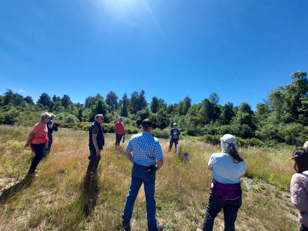
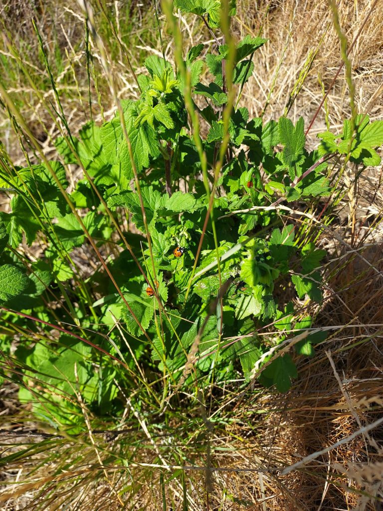
The Chahalpam restoration efforts include invasive weed removal and replanting with native riparian plant species to recover some of the lost forest that protects the river. Funding has been secured from multiple sources, including the Marion SWCD Conservation Assistance Grant (formerly known as Landowner Assistance Program). Some of the plantings we saw included Oregon ash, Douglas-fir, red alder, black cottonwood, osoberry, mock orange, red flowering currant, black twinberry, beaked hazelnut, and more. The restoration crews used by the Tribes to maintain these project areas spot spray and mow each year to keep weeds down near the native plantings. They have found that letting some of the grasses continue to grow provides shade for seedlings during hot summers, helping them endure heat waves and drought. Traditional Ecological Knowledge (TEK) management techniques and practices are used. TEK practices are based on long-term goals and planning: thinking of how the site will function in seven generations, rather than the 3-year restoration project timelines we often see in today’s conservation world. This diligent patience helps to relieve pressure on the land, reduce harsh management strategies and chemical use, and allows the ecosystem to recover itself with time.
We enjoyed a lunch break after our walk around the site, and everyone who attended received a Streamside Planting and Maintenance Workbook (Clackamas SWCD) to assist with their own riparian management goals after the tour.
The Hebing Family
The next site for our Conservation Club tour led us down Highway 22, into the burn area from the 2020 Labor Day wildfires. This site was at a private landowner’s family property along the North Santiam River in Lyons. The Hebings greeted all of the tour attendees with big smiles, happy to share their beautiful home with us. Mike shared sun tea he brewed himself to keep us refreshed as we walked the restoration site and admired all of the beautiful native flowers in bloom.
The project area was about 5 acres total, and had quite a different journey of conservation, due to the impacts from the natural disaster. The family is not new to conservation, having completed wildlife habitat enhancement projects and conservation farming practices before the fires. Despite the unfortunate loss of those efforts and projects in the wildfires, the family’s determination to steward their land remains strong.
Wildfire Damage
The wildfires burned through the entire Hebing family property, sparing some of the structures due to the Hebings’ fast action to put out the sprinklers around the homes. However, the native plant community was lost and left a huge mess behind for the landowners to clean up. What was once dense old growth forest, was now scorched trees left standing and piled up in huge piles, creating dangerous hazards. This also opened up the canopy to sunlight that hadn’t reached the forest floor in decades, and triggered a previously dormant seed bed of Scotch broom. If you’ve been into the burn area at all since the fires, especially during April – June, all you will see in the burned forests is a sea of yellow flowers. This is the invasive Scotch broom taking over the understory, inhibiting native plants from growing.
Support for Restoration Efforts
Mike Hebing received a Conservation Assistance Grant and completed a restoration project for his family’s property to remove the woody slash left on site, remove the invasive scotch broom, plant native species, build habitat brush piles and install bird houses (made from salvaged timber from his site) to help recover some of the lost wildlife habitat. Luckily, having professional experience with land clearing and tree work as his job, Mike was able to complete all of the labor himself and count that as his match to receive grant funds. Restoration projects can add up quickly and be quite expensive, especially for a small landowner who has already lost so much to a natural disaster. However, Mike was able to be resourceful and look for free plant giveaways from partnering agencies at the end of planting season and home them in his nursery with irrigation over the summer. He received leftover native willows, Red Osier dogwood, and Douglas fir bareroots and potted them. Making sure he kept them watered over the summer, Mike kept the plants alive so he can plant them in his site at the proper time during the winter.
Wildlife Viewing
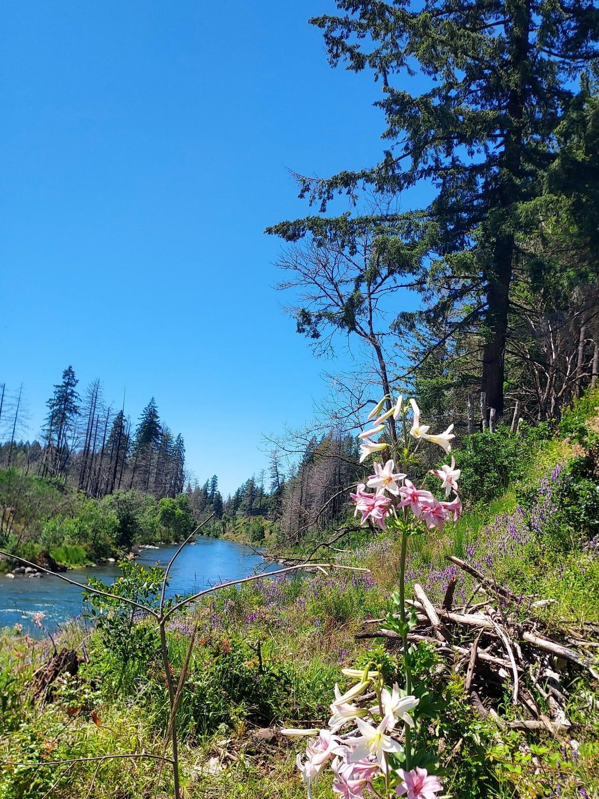
We enjoyed the beautiful view of the river and learning about the native plants that Mike had planted, as well as the natural regeneration of plants that many of us didn’t expect to see, such as the Cascade Lily (Lilium washingtonianum Kellogg). We even watched ospreys and a bald eagle flying right over our heads, which put the cherry on top of an amazing day.
Further Resources and Upcoming Opportunities
Visit these resources to learn more about healthy riparian habitats!
- Streamside Planting and Maintenance Workbook (Clackamas SWCD)
- OSU Extension Riparian Areas
- Oregon Conservation Strategy: Flowing Water and Riparian Habitats
- Oregon Explorer: Floodplain Restoration in the Willamette Basin
Join us for upcoming opportunities to get involved with riparian events!
- Stream Celebration 8/22/24
- Salmon Watch Volunteer Training 8/28/24
- Conservation Reserve Enhancement Program: Conservation Spotlight Interview with Rachel Kato
We hope you join us at our next Conservation Club event! If you are interested in sharing your conservation story with the community, please reach out about opportunities to write a blog post or even host a future event tour at your site!
Related Resources
About the Author
My passion for conservation is rooted in my experiences growing up camping and backpacking every summer since I was young. My favorite activities always involve being outside, whether I am hiking, snowboarding, or biking, I love to explore as much natural beauty as possible. I help Marion County residents improve the health and productivity of their land as the Conservation Planner for natural areas.